The old quarrymen’s paths that wind through Eryri (Snowdonia) tell stories you won’t find on summit trails. Instead of chasing peaks, the Snowdonia Slate Trail follows the working landscape, skirting vast quarries, passing through tight-knit slate villages and revealing the industrial archaeology that shaped these mountains over two centuries.
This 83-mile circular route connects the six areas of the Slate Landscape of Northwest Wales UNESCO World Heritage Site, but here’s the thing: you don’t need to walk all 83 miles to experience its best moments.
The trail divides into 13 waymarked sections, each revealing different aspects of the slate story. Some sections pass right through Betws-y-Coed and the Conwy Valley, practically on your doorstep from our cottages, while others venture into remote slate-working valleys where you’ll walk for hours seeing more sheep than people.
This guide focuses on the best day walks: the sections you can tackle during a week’s stay, returning each evening to a hot tub, a heated indoor pool and a comfortable base to plan tomorrow’s route.
Want the full story behind what you’re walking through? Our guide to the Welsh Slate Landscape covers the history, the UNESCO designation and why this corner of North Wales changed the world.
The Trail at a Glance
- Distance: 83 miles (134km) full circuit
- Sections: 13 waymarked sections, ranging from 3 to 13 miles each
- Difficulty: Moderate. No major summits, but plenty of ascent
- Waymarking: Distinctive slate-themed markers throughout
- Dog-friendly: Generally yes. Open access land and paths rather than farmland
- Best for: Understanding the landscape through walking rather than just viewing it
What makes it special is what it deliberately avoids. This trail steers clear of the honeypot summits, exploring instead the less-visited corners: old tramways, the flooded pits that have turned an extraordinary turquoise, forests reclaiming old workings and villages where Welsh culture and language remain vibrantly alive.
Why Walk the Slate Trail?
- For the quiet – While thousands climb Yr Wyddfa (Snowdon) daily, you’ll often walk the Slate Trail for hours without seeing another soul. This is Eryri’s peaceful side.
- For the history you can touch – Every mile reveals industrial heritage: Victorian quarry buildings, ancient tramway routes, workers’ cottages, chapel ruins. This isn’t history behind glass; it’s history you can explore and understand.
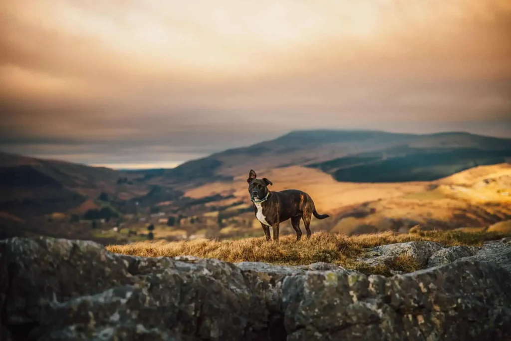
- For dog walkers – These paths follow open access land and established trails rather than farmland, making them genuinely good for dogs. Keep them on leads near quarry workings and cliff edges, and you’ll find most sections excellent for a walking holiday with your four-legged friend.
- For variety – Mountain passes, river gorges, forests, moorland, lake shores and working villages: the scenery changes constantly, but the slate thread connects it all.
- For the culture – Small chapels, slate-carved memorials, community pubs. These villages maintain a strong Welsh identity and walking through them connects you to a culture forged in the quarries.
- For the colours – When it rains (and this is Wales, so it will), the slate transforms. Wet slate reveals purples, greys and silvers that simply aren’t visible when dry, making moody weather atmospheric rather than miserable.
A good base makes a great day out.
Fig Tree and Laurel sit high above the Conwy Valley, a short drive from the mountains, the coast and everything in between. Private hot tubs, a heated indoor pool and a warm welcome for dogs.
Explore the cottagesThe Best Slate Trail Day Walks
These sections work brilliantly as standalone day hikes during your stay at our holiday cottages.
Section 13: Betws-y-Coed to Capel Curig (10km / 6.2 miles)
Distance: 6.2 miles
Time: 2.5-3 hours
Ascent: 100m (gentle)
Start: 20 minutes from our cottages
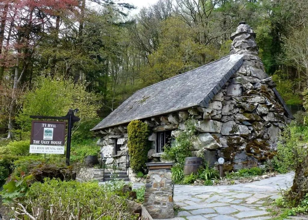
Why walk it: This is your doorstep section. Easy riverside walking with open mountain views, Rhaeadr Ewynnol (Swallow Falls) and Tŷ Hyll (the Ugly House) with its overnight-build legend.
The route: Starting from Betws-y-Coed, follow the riverside path past Rhaeadr Ewynnol, one of Wales’ most photographed waterfalls (you’ll pay to enter the viewing area). The trail continues past Tŷ Hyll, a charming stone cottage supposedly built overnight in the 15th century to claim squatters’ rights.
The well-engineered woodland path gradually opens to reveal mountain panoramas as you approach Capel Curig. The Snowdon Horseshoe dominates the western skyline while the jagged peaks of the Glyderau rise to the north.
What you’ll see:
- Rhaeadr Ewynnol (viewing platform accessible with ticket)
- Tŷ Hyll (now a tea room, excellent for refreshments)
- Ancient oak woodland alongside Afon Llugwy
- Opening mountain views towards Tryfan and Yr Wyddfa
- Gentle, well-maintained paths throughout

Perfect for: Families, those wanting an easy first taste of the trail, dog walkers, anyone wanting mountain views without the climb.
Rainy day verdict: Excellent. The woodland provides some shelter and the waterfalls are more dramatic. The slate-grey river against wet slate boulders is particularly atmospheric.
How to do it:
- One-way walk: Park in Betws-y-Coed, walk to Capel Curig, return on Sherpa’r Wyddfa (Snowdon Sherpa) S2 or S4
- There and back: Walk out and return the same way (12.4 miles total)
- Circular option: Combine with quiet lanes for a loop (adds 2-3 miles)
- Start point: Betws-y-Coed village centre (multiple car parks)
- Bus links: Sherpa’r Wyddfa S2 and S4 serve both villages
- Refreshments: Betws-y-Coed (multiple cafés), Tŷ Hyll tea room (seasonal), Capel Curig (Pinnacle Café, Plas y Brenin)
- Dogs: Welcome throughout
Section 12: Llan Ffestiniog to Betws-y-Coed (20.8km / 12.9 miles)
Distance: 12.9 miles
Time: 5-6 hours
Ascent: 320m
Start: 45 minutes from our cottages
Why walk it: The longest section, but one of the most beautiful and varied. This is the full slate landscape experience in a single day: remote mines, hidden gorges, dramatic waterfalls and woodland walking.
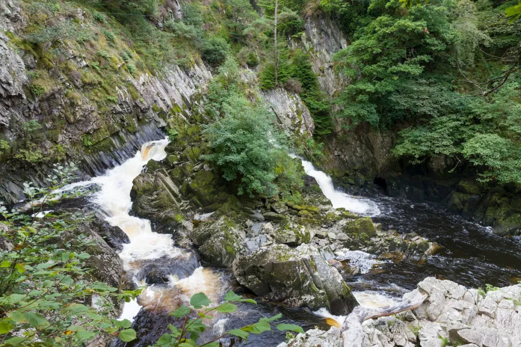
The route: Starting from the quieter village of Llan Ffestiniog, the trail climbs through hills revealing abandoned slate mines before descending through Ceunant Cynfal, a hidden gorge that most visitors miss entirely. The path then approaches Rhaeadr y Graig Lwyd (Conwy Falls), spectacular cascades through a slate gorge, before following Afon Conwy through woodland to arrive at Betws-y-Coed. The final miles are gentle riverside walking with mountain views opening up ahead.
What you’ll see:
- Abandoned slate mines in remote moorland
- Ceunant Cynfal gorge (dramatic and little-visited)
- Rhaeadr y Graig Lwyd thundering through slate channels
- Ancient woodland alongside the river
- The transition from industrial to natural landscape
- Moelwyn range views
Perfect for: Experienced walkers wanting a full day out, those interested in industrial archaeology, anyone wanting to escape the crowds entirely.
Rainy day verdict: The gorge and falls are magnificent in wet conditions, and the woodland provides shelter. Wet slate reveals colours you won’t see in sunshine. However, the moorland section can be boggy: wear proper boots.
How to do it:
- One-way walk: This works best as a linear walk. Drop a car in Betws-y-Coed or arrange pick-up, or consider a taxi to the start (Llan Ffestiniog has limited public transport)
- Alternative start: Begin at Penmachno, roughly halfway, and walk to Betws-y-Coed for a shorter 6-7 mile option
- Start point: Llan Ffestiniog village
- Parking: Betws-y-Coed (multiple car parks), limited parking at Llan Ffestiniog
- Refreshments: Limited options at start, Betws-y-Coed well-served at finish
- Navigation: Download offline maps. Phone signal is poor throughout
- Dogs: Welcome throughout, but be aware of sheep in moorland sections
- Difficulty: This is a proper day’s walking. Bring full kit
Section 7: Beddgelert to Nantmor (7.2km / 4.4 miles)
Distance: 4.4 miles
Time: 2-3 hours
Ascent: 400m
Start: 50 minutes from our cottages
Why walk it: The famous Bwlch Aberglaslyn (Aberglaslyn Pass), one of Wales’ most impressive river gorges. The scenery is exceptional, the distance is manageable and you can visit Gelert’s Grave in Beddgelert village before or after your walk.
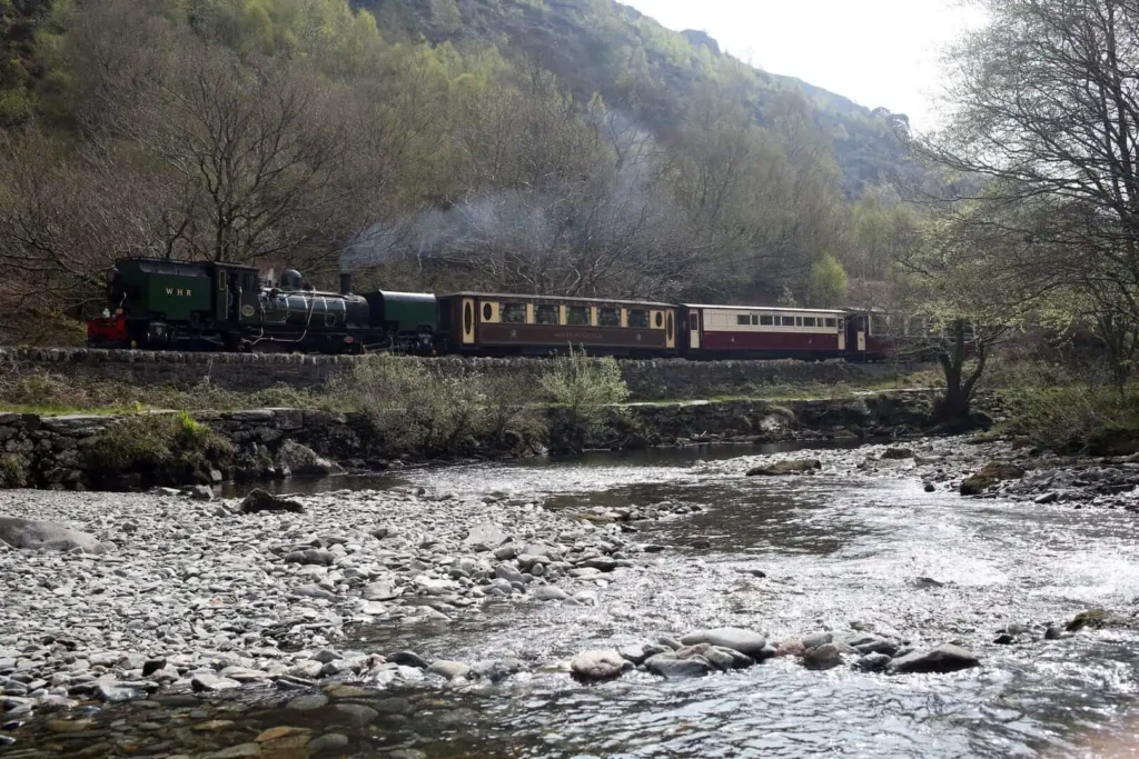
The route: Starting from Beddgelert, the trail follows Afon Glaslyn upstream through the Bwlch Aberglaslyn. The river carves through a narrow gorge with towering rock faces on either side, creating one of Eryri’s most photographed landscapes. The path follows the old Welsh Highland Railway route, hugging the cliff face with the river rushing below; metal railings and good engineering make this accessible despite the drama. The gorge eventually opens out towards Nantmor.
What you’ll see:
- The full drama of Bwlch Aberglaslyn
- Rushing river through slate gorge
- Historic railway engineering (bridges and tunnels)
- Mountain views at either end
- Woodland and open hillside
Perfect for: Photographers, geology enthusiasts, those wanting dramatic scenery without extreme difficulty, families with older children. Younger children need close supervision near the cliff edges.
Rainy day verdict: Outstanding. The river is at its most powerful, and the wet slate rock faces gleam. This walk is arguably better in moody weather. The path can be slippery, though; good footwear is essential.
How to do it:
- One-way walk: Park in Beddgelert, walk to Nantmor, return on the Welsh Highland Railway (seasonal) or arrange pick-up
- There and back: Walk out and return the same way (8.8 miles total); the gorge is equally dramatic in both directions
- Circular extension: Link with quiet lanes and paths for a longer circular route (various options available)
- Start point: Beddgelert village (car parks available, can get busy)
- Parking: Pay and display in Beddgelert
- Refreshments: Beddgelert has multiple cafés and pubs
- Path conditions: Well-maintained but can be narrow and exposed in places
- Dogs: Welcome, but keep on lead through the gorge (sheep nearby and narrow path)
- Accessibility: Not suitable for pushchairs or wheelchairs


Section 2: Bethesda to Llanberis (11.6km / 7.2 miles)
Distance: 7.2 miles
Time: 3-4 hours
Ascent: 360m
Start: 45-50 minutes from our cottages
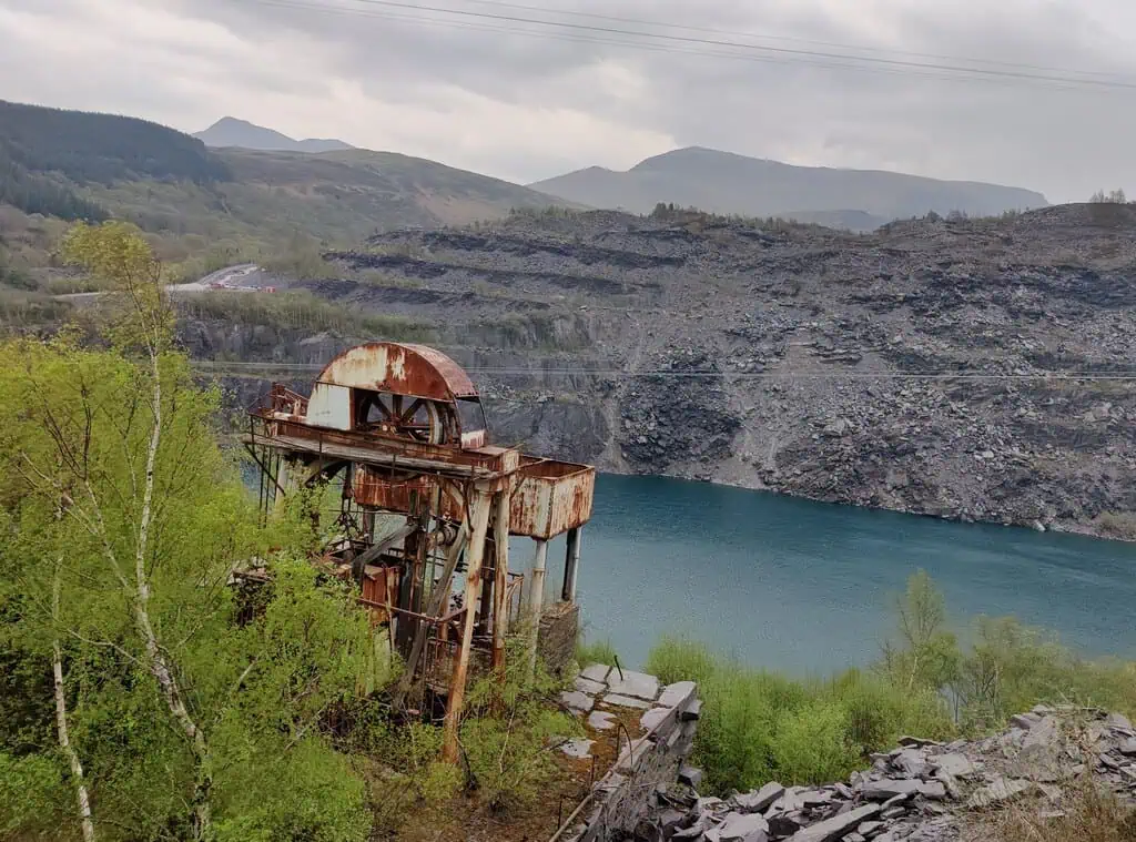
Why walk it: See both Penrhyn and Dinorwig quarries in one walk. This is where you truly understand the scale of slate extraction: massive terraced galleries carved into mountains, spoil heaps the size of hills and the full drama of industrial archaeology.
The route: Starting from Bethesda, the village that bore the brunt of the Great Strike, the trail skirts Penrhyn Quarry before drawing close to Dinorwig Quarry, which burrows deep into Elidir Fawr. The descent into Llanberis reveals the full scale of Dinorwig’s workings: at its peak, this quarry employed over 3,000 men.
What you’ll see:
- Penrhyn Quarry terraces (once the world’s largest)
- Dinorwig Quarry galleries carved into the mountainside
- Massive spoil heaps dominating the landscape
- Llyn Padarn (Llanberis Lake) below Dinorwig
- The contrast between industrial heritage and natural beauty
- Views towards Yr Wyddfa
Perfect for: Industrial heritage enthusiasts, photographers, anyone wanting to understand the sheer scale of what was achieved here, history buffs interested in the Great Strike story.
Rainy day verdict: Good. The quarries are dramatic in any weather, and Llanberis has excellent indoor facilities. When the National Slate Museum reopens in 2026/27, this walk will be even better. The higher sections can be exposed to wind, so bring proper waterproofs.
How to do it:
- One-way walk: Park in Llanberis, take bus T10 to Bethesda, walk back (downhill finish)
- Or reverse: Park in Bethesda, walk to Llanberis, return on bus (uphill finish)
- Alternative: Drive to midpoint (limited parking) and walk both directions
- Start/finish: Bethesda or Llanberis (both have parking)
- Bus links: T10 serves both villages
- Refreshments: Both villages well-served with cafés and pubs
- Quarry access: Stay on marked paths. Quarries are dangerous
- Dogs: Welcome, but keep on lead near quarries and sheep
- Museum: National Slate Museum in Llanberis (currently closed until 2026/27)

Section 3: Llanberis to Waunfawr (6.1km / 3.8 miles)
Distance: 3.8 miles
Time: 2-3 hours
Ascent: 310m
Start: 45-50 minutes from our cottages
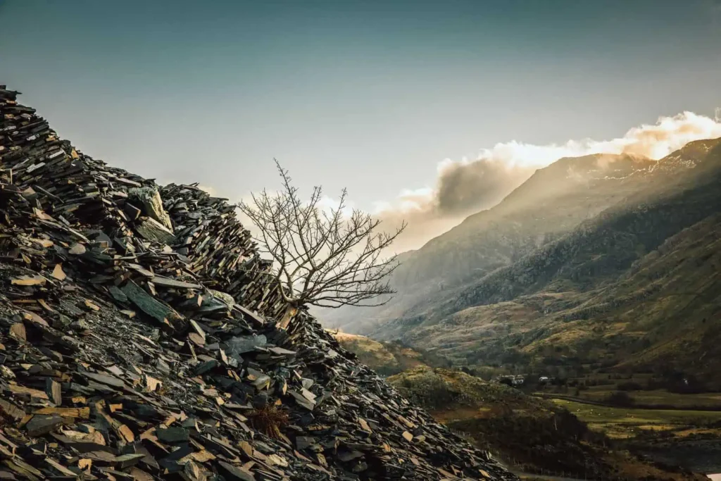
Why walk it: The shortest section but the most intensively worked landscape on the entire trail. Slate archaeology at its most concentrated: spoil tips, shafts, inclines and abandoned levels everywhere you look.
The route: Climbing out of Llanberis, you’re immediately surrounded by the remains of Dinorwig Quarry. The path threads through a labyrinth of industrial remains, with slate waste dominating every view. This is where extraction feels most visceral; you’re walking through the working landscape itself, not observing it from a distance.
What you’ll see:
- Dinorwig Quarry workings on all sides
- Incline routes carved into hillsides
- Spoil heaps defining the skyline
- Abandoned quarry buildings and machinery
- Views to Yr Wyddfa
- The transition from industrial to rural landscape approaching Waunfawr

Perfect for: Half-day walks, industrial archaeology enthusiasts, those wanting intense slate heritage without long distances, testing your fitness before longer sections.
Rainy day verdict: Mixed. The industrial features are fascinating in any weather, but the higher sections are exposed with little shelter. Save this one for clearer days when you can appreciate the full landscape.
How to do it:
- One-way walk: Park in Waunfawr (limited parking), take bus to Llanberis, walk back
- Or reverse: Park in Llanberis, walk to Waunfawr, return by bus
- Circular option: Link with lanes or the Lôn Eifion cycle path for a longer loop
- Start/finish: Llanberis or Waunfawr
- Bus links: Regular buses between both villages
- Parking: Llanberis has multiple car parks, Waunfawr has limited roadside parking
- Refreshments: Llanberis well-served, Waunfawr has limited options
- Safety: Stay on paths. Old quarry workings are dangerous
- Dogs: Welcome, but keep on lead near old workings
Section 14: Capel Curig to Bethesda (17km / 10.6 miles)
Distance: 10.6 miles
Time: 4-5 hours
Ascent: 100m (relatively flat)
Start: 30-35 minutes from our cottages
Why walk it: Epic mountain scenery with minimal ascent. This section follows the dramatic Nant Ffrancon glacial valley with Tryfan dominating the skyline, its famous Adam and Eve summit rocks visible on clear days. The perfect walk for those wanting big views without big climbs.
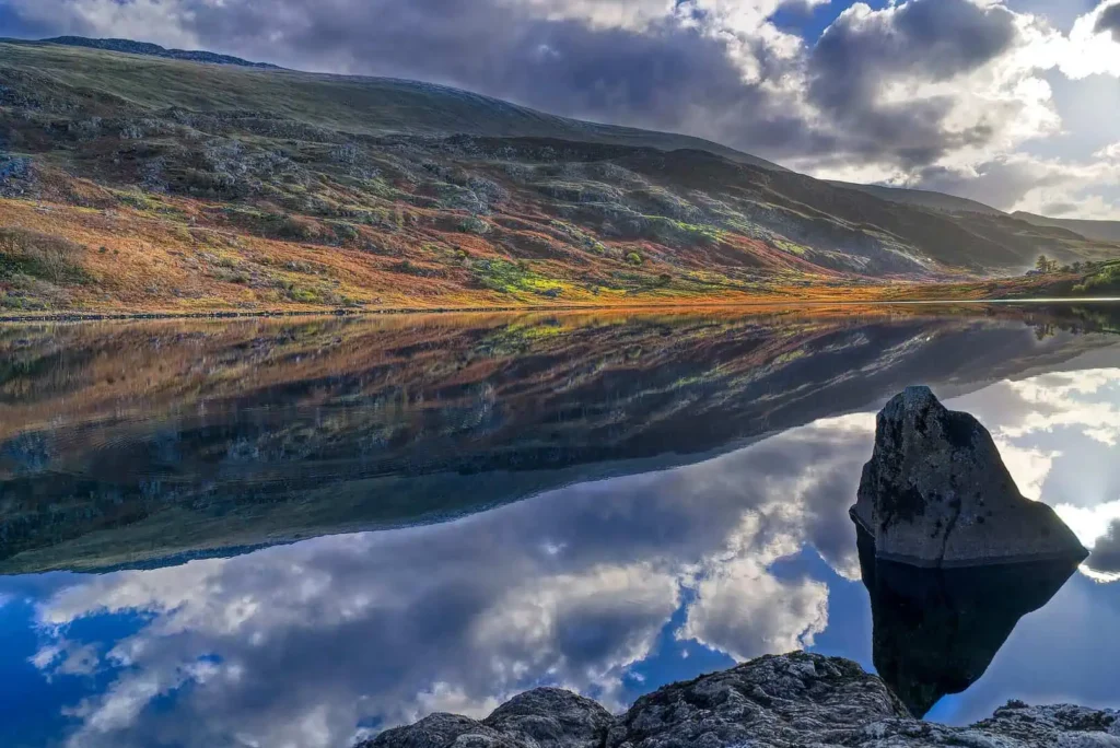
The route: Starting from Capel Curig, the trail passes Llyn Ogwen, where legend says Excalibur was thrown after King Arthur’s death, before following the valley down past Tryfan’s imposing bulk. The dramatic U-shaped Nant Ffrancon valley was carved by glaciers, and walking its floor gives you a genuine sense of geological scale. The final section follows the Lôn Las Ogwen cycle path, an easy, traffic-free route, into Bethesda, returning you to slate country.
What you’ll see:
- Llyn Ogwen reflecting the mountains
- Tryfan’s famous pyramid shape with Adam and Eve rocks visible on the summit
- The dramatic Glyderau range
- Nant Ffrancon glacial valley
- Transition from high mountains to slate villages
- Easy finish on traffic-free cycle path

Perfect for: Mountain scenery without the climb, geology enthusiasts, photographers, longer day walks with relatively easy terrain, cyclists (the cycle path section).
Rainy day verdict: The mountain views are the main attraction here; consider saving this for clearer days. The Ogwen Valley can be atmospheric in mist, but you’ll miss the drama if visibility is poor.
How to do it:
- One-way walk: Park in Bethesda, take Sherpa’r Wyddfa S4 to Capel Curig, walk back (gentle downhill finish)
- Or reverse: Park at Ogwen (limited parking), walk to Bethesda, arrange pick-up
- Shorter option: Walk just the Capel Curig to Ogwen section (about 4 miles)
- Start/finish: Capel Curig or Bethesda
- Bus links: Sherpa’r Wyddfa S4 serves Capel Curig; T10 serves Bethesda
- Parking: Limited at Ogwen (arrive early or pre-book), Bethesda has options, Capel Curig roadside
- Refreshments: Capel Curig (Pinnacle Café, Plas y Brenin), Bethesda (multiple options)
- Path conditions: Easy Lôn Las Ogwen cycle path for final section
- Dogs: Welcome throughout
Other Notable Sections Worth Considering
For Remote Atmosphere: Croesor to Tanygrisiau (Section 9)
Distance: 5.3 miles
Time: 2.5-3 hours
Start: 60 minutes from our cottages
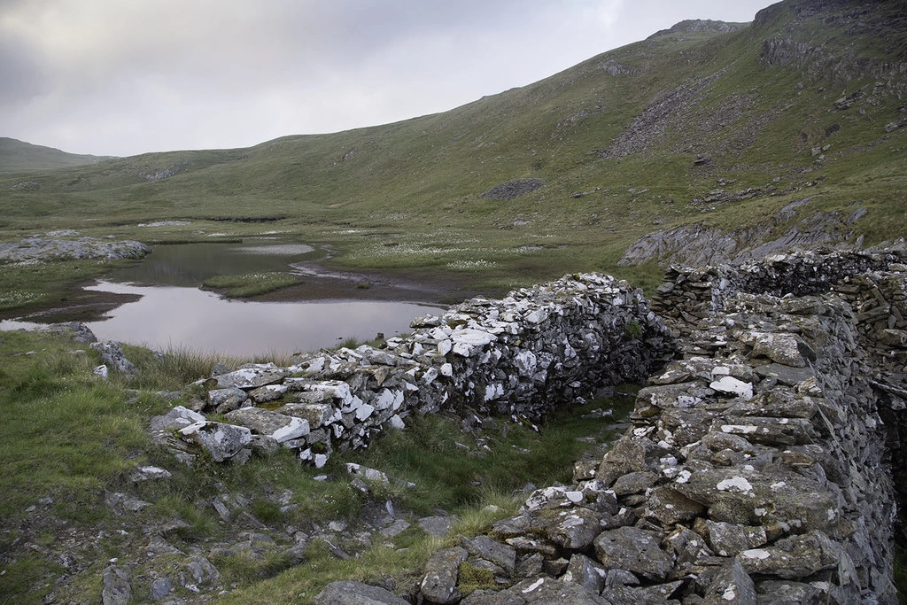
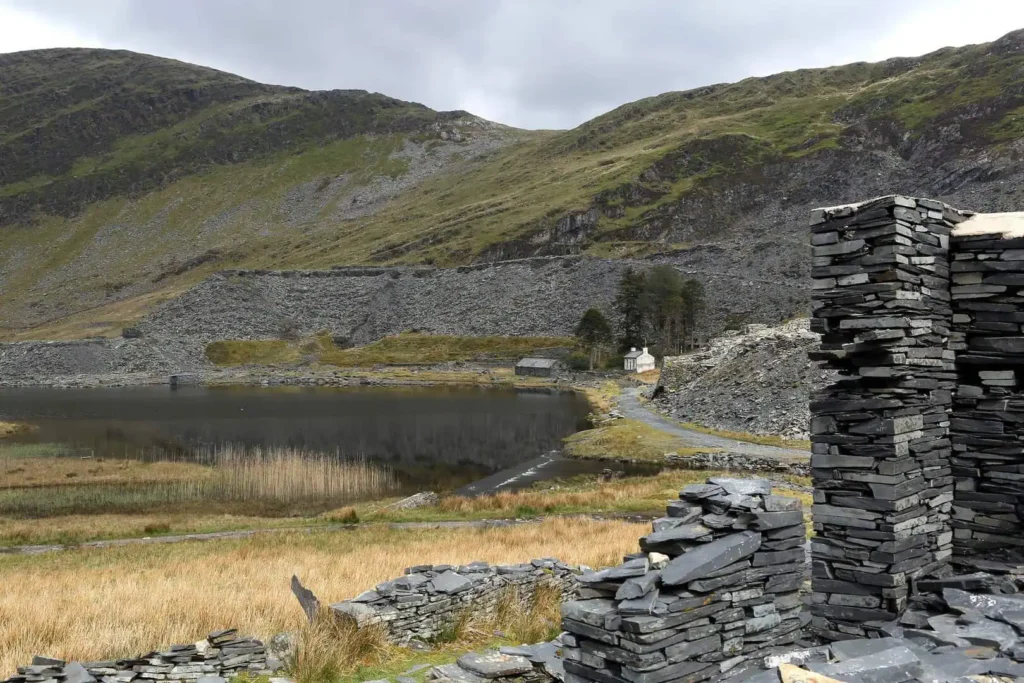
Abandoned slate-built homes, underground tunnels visible from the surface and the highest point of the entire trail at 526m. This is wild, remote country with the dramatic Llyn Croesor dam at the finish. Save it for those wanting genuine solitude and a sense of slate’s industrial scale.
For Slate Capital Immersion: Tanygrisiau to Blaenau Ffestiniog (Section 10)
Distance: 2.1 miles
Time: 1-1.5 hours
Start: 40 minutes from our cottages
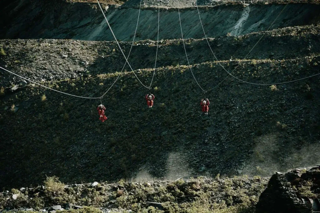
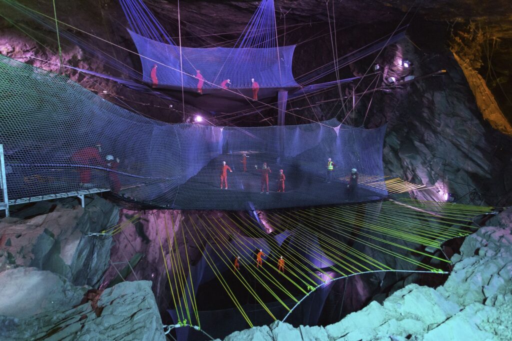
A short walk into Blaenau Ffestiniog, the slate capital itself. Surrounded by vast spoil heaps and working quarries, this town is slate through and through. Look for Welsh sayings carved into the High Street pavement and the River of Slate sculpture. Combine with a visit to Zip World Llechwedd for the full Blaenau experience.
Walking in the Rain: When Wet Weather Makes It Better
Here’s a secret about the Slate Trail: rain doesn’t ruin these walks. It transforms them.
Wet slate reveals colours that are invisible in dry conditions: those grey spoil heaps turn purple and silver, the rivers thunder through gorges at their most powerful and the falls surge with double their usual force. Moody weather doesn’t diminish the experience here; it intensifies it.
Best wet-weather sections:
- Bwlch Aberglaslyn (Section 7): The river at full power through the gorge is impressive
- Betws-y-Coed to Capel Curig (Section 13): Rhaeadr Ewynnol (Swallow Falls) at their most dramatic, woodland provides shelter
- Llan Ffestiniog to Betws-y-Coed (Section 12): Rhaeadr y Graig Lwyd (Conwy Falls) and Ceunant Cynfal gorge are magnificent when wet
Alternative wet-weather option: Stick to lower-level paths like Padarn Country Park (Llanberis lakeshore circuit) or the valley floor sections. The slate colours are vivid when wet and you’ll avoid exposed high ground.
Not sure the Slate Trail is for you on a wet day? Our Rainy Day in North Wales? Make It Unforgettable guide has plenty of indoor and undercover alternatives across the valley.
Practical Walking Guide
Navigation
The trail is well-marked with distinctive slate-themed waymarkers throughout. Never rely solely on them, though: weather, vegetation and occasional vandalism can obscure markers.
Essential maps:
- OS Maps OL17 (Snowdonia) covers most sections
- OL23 (Snowdonia South) needed for Croesor to Betws-y-Coed section
- Download GPX files from the official Snowdonia Slate Trail website
- Download offline maps – phone signal is poor in many areas
Aled Owen’s Snowdonia Slate Trail guidebook (Rucksack Readers, £14.99) provides detailed route descriptions, maps and background information for all sections.
Using Public Transport
The trail is well-served for section walking:
Sherpa’r Wyddfa Services:
- S2: Betws-y-Coed to Pen-y-Pass (passes through Capel Curig)
- S4: Capel Curig to Bangor via Ogwen Valley and Bethesda
- S6: Betws-y-Coed to Beddgelert
- Visit the official Sherpa’r Wyddfa website for prices and timetables
T10 Service: Bangor to Llanberis via Bethesda
Regular buses connect most trail towns.
Heritage railways: The Welsh Highland Railway and Ffestiniog Railway can transport you between sections on seasonal services.
Download timetables before you go. Services are reduced in winter, and phone signal is poor for checking on the go.
What to Bring
Essential for every walk:
- Full waterproof jacket and trousers
- Warm layers (mountain weather changes fast)
- Walking boots with good ankle support and grip
- OS maps and compass. Don’t rely on phone signal
- First aid kit
- Head torch (days shorten quickly in autumn and winter)
- Emergency food and water
- Whistle
- Fully charged phone
Recommended:
- Walking poles (helpful on ascents and descents)
- Camera
- Binoculars (for viewing quarry details and wildlife)
- Guidebook or downloaded route notes
- Flask of hot drink
Facilities: Carry enough water and snacks between villages. Shop opening hours can be limited; plan ahead. Some villages have no shops at all, mobile phone signal is patchy and public toilets are limited to main villages.
Best Time to Walk
🌸 Spring (April-May): Wildflowers emerging, fewer crowds, weather variable but days lengthening. Some accommodation may still be closed and the ground is drying out after winter.
☀️ Summer (June-August): Longest days, best weather (though still Welsh weather). Busiest period: car parks fill early. Midges can be a nuisance in still conditions, but full facilities are open.
🍂 Autumn (September-October): Beautiful colours in the forests, fewer walkers and good weather often continues into September. Days shorten by October and the ground can be boggy after rain.
❄️ Winter (November-March): Atmospheric and dramatic, very quiet, with short days limiting distances. Weather can be harsh. Not recommended unless you’re experienced in winter mountain conditions.
May, September and early October offer the best balance of weather, daylight hours and open facilities.
Safety Considerations
- Stay on paths – Old quarry workings are dangerous: hidden shafts, unstable spoil heaps and flooded pits lie off the marked routes. The slate may look solid but can be slippery and unstable.
- Weather changes fast – Mountain conditions can develop quickly. Check forecasts and be prepared to turn back.
- Tell someone your plans – Always let someone know your route and expected return time.
- Emergency contacts – Mountain Rescue: Call 999. Download the What3Words app for precise location sharing in areas with limited signal.
Quarry hazards:
- Do not enter quarry buildings. They’re unstable
- Do not climb spoil heaps. They can collapse
- Do not swim in quarry lakes. They’re dangerously cold and deep
- Do not ignore safety barriers where present
Dogs on the Trail
Most sections are dog-friendly, following open access land and established paths rather than farmland, making this excellent for a walking holiday with your dog.
Considerations:
- Keep dogs on leads near sheep, quarry workings and cliff edges
- Carry water for your dog (streams may be contaminated by old mine workings)
- Be aware some sections have stiles and narrow paths
- Check accommodation accepts dogs before booking
- Clean up after your dog
Best dog-friendly sections:
- Betws-y-Coed to Capel Curig: Easy, well-maintained, minimal hazards
- Bwlch Aberglaslyn: Dramatic, but keep on lead throughout
- Capel Curig to Bethesda: Traffic-free cycle path section is ideal
The Conwy Valley and wider Eryri region are excellent for dogs, with forest trails, open moorland and dog-friendly beaches all within easy reach. Read our complete guide to visiting the area with your dog to find out more.
Reading the Industrial Landscape
Understanding what you’re seeing transforms these walks from pleasant hikes into journeys through industrial archaeology.
Key features to spot:
- Quarry terraces: Stepped galleries cut into mountainsides where slate was extracted level by level. Each gallery represents years of work.
- Spoil heaps: Conical or ridge-shaped piles of waste rock. Only 10-15% of extracted rock was usable slate; the rest was waste. The size of spoil heaps indicates the scale of extraction.
- Inclines: Steep tramways using gravity and counterweights to move slate up and down mountains. Look for straight scars on hillsides.
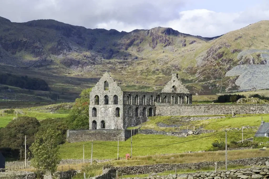
- Engine houses: Stone buildings that housed steam engines for winding gear and pumps. Usually the most substantial buildings remaining.
- Processing mills: Where slate was split, shaped and graded. Often identifiable by distinctive roof shapes and large door openings.
- Workers’ barracks: Small stone shelters where men stayed during the week, many living too far to travel home daily. Usually simple rectangular buildings.
- Tramway routes: Narrow paths carved into hillsides, often still clearly visible. Some have been converted into walking trails.
- Flooded quarry pits: Vivid turquoise lakes filling old workings. The blue colour comes from minerals in the water, and they’re dangerously deep.
Why the different colours? Slate varies from dark grey to purple-grey to green-grey depending on the specific geology. When wet, these colours become vivid.
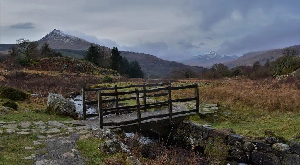
Your Conwy Valley Connection
From our Conwy Valley cottages, Fig Tree and Laurel, you’re perfectly placed to explore the Slate Trail without long drives at either end of the day. Section 13 begins just 20 minutes away in Betws-y-Coed, Section 14 is around 30-35 minutes to Capel Curig, and Section 12 finishes in Betws-y-Coed itself. Every other major section, including Blaenau Ffestiniog, Llanberis and Beddgelert, is within 40-60 minutes.
It makes flexible walking easy: tackle different sections across your stay, try a shorter route before committing to a longer one, or pair a morning on the trail with an afternoon at Zip World or the heritage railways. And if not everyone in your group wants to walk, there’s plenty to enjoy back at the cottages – the indoor pool and hot tubs are always there when staying in feels like the better option.
After a day on the trail, the view shifts but the skyline doesn’t. The Carneddau range and the peaks of Eryri fill the horizon from the patio – the same mountains you’ve spent the day walking through, now seen from a different angle.

Final Thoughts: Why Walk This Trail
The Snowdonia Slate Trail isn’t just another footpath through pretty scenery. It’s a journey through a landscape fundamentally shaped by human endeavour: where communities carved an industry from solid rock, where Welsh language and culture flourished even through industrial hardship, and where the legacy of that extraordinary period remains visible in every valley.
Walking these paths, you’ll understand why UNESCO designated the Slate Landscape as having universal value. This isn’t history preserved behind glass; it’s living heritage you can explore, touch and experience. The quarries that seem so dramatic today once rang with the sound of thousands of men at work. The quiet valleys you walk through were once bustling industrial centres. The spoil heaps that define the skyline represent millions of tons of rock moved by hand.
Every step reveals another layer of this story. And once you’ve walked the Slate Trail, you’ll never look at North Wales, or slate itself, the same way again.
Ready to explore the slate landscape on foot? Whether you tackle multiple sections during your stay or choose a favourite for a memorable day walk, the Snowdonia Slate Trail offers a uniquely rewarding way to understand how Wales roofed the world.
FAQs
Which Slate Trail section is best for a first-time walk?
Section 13 (Betws-y-Coed to Capel Curig) is the best starting point. It’s only 6.2 miles with minimal ascent, well-maintained throughout, and offers mountain views without the climb. Tŷ Hyll (the Ugly House) provides a convenient refreshment stop, and you can return on the Sherpa’r Wyddfa (Snowdon Sherpa bus) if needed. The start is 20 minutes from our cottages.
Can I walk sections of the Slate Trail with young children?
Yes, but choose carefully. Section 13 (Betws-y-Coed to Capel Curig) works well for children who can walk 6 miles on well-maintained paths. Section 3 (Llanberis to Waunfawr) is only 3.8 miles but has more ascent. Avoid Bwlch Aberglaslyn (the Aberglaslyn Pass – Section 7) with very young children: the path is narrow with exposed drops in places.
Are the walks suitable for dogs?
Most sections are dog-friendly, following open access land and established paths rather than farmland. Keep dogs on leads near sheep, quarry workings and cliff edges, particularly on the Bwlch Aberglaslyn. Sections 13 and 14 are particularly good: well-maintained paths with minimal hazards. Always carry water for your dog, and clean up after them.
How do I get back to my car after a one-way walk?
The Sherpa’r Wyddfa bus services connect most trail sections. The S2, S4 and S6 routes cover the northern sections, and the T10 serves Llanberis and Bethesda. Download timetables before you go as signal is poor in the mountains. Walking out and back on the same route is also a good option: many sections are equally rewarding in both directions.
What makes the Slate Trail different from other Eryri (Snowdonia) walks?
The trail deliberately avoids the summit routes that dominate Eryri walking. Instead, it explores the industrial landscape: old quarry tramways, slate villages and the archaeology of an industry that once supplied much of the world’s roofing slate. You’ll walk through working history rather than just viewing natural scenery. It’s quieter, more cultural and tells a uniquely Welsh story.
Is the trail well waymarked, or do I need maps?
The trail has distinctive slate-themed waymarkers throughout, but never rely solely on them. Weather, vegetation and occasional vandalism can obscure markers. Always carry OS Maps OL17 (covers most sections) and download GPX files from the Snowdonia Slate Trail website. Most importantly, download offline maps before you leave: phone signal is unreliable in many areas, and you won’t be able to access online navigation when you need it most.
Some images: © Crown Copyright